“Not all those who wander are lost.” – J. R. R. Tolkien, The Riddle of Strider
One of the key motivators for field researchers who choose mobile data collection is the ability to collect rich digital information that simply cannot be collected through pen and paper. Handheld phones have come a long way since their invention 45 years ago. Today, a mobile phone in your hands is also a camera, a sound recorder, a navigation device and much more. These features enable field researchers to capture images, audio and even location data.
Just over 10 years ago, Global Positioning System (GPS) technology was only available in highly specialized devices. It was expensive, relatively cumbersome and generally inaccessible to all but the best funded and mission-critical research projects. Today, even a $50 budget phone has an inbuilt GPS receiver, and a small research team can conduct a major mapping exercise for a song.
But, given its ubiquity and affordability, GPS technology is no longer just limited to mapping work. More and more projects also deploy it for quality control, relying on it to ensure that enumerators are in the right place at the right time. Like many modern data collection applications, Hoji provides this capability out of the box.
Today, we’re going to cover some of the issues that researchers need to understand when deploying GPS technology in their data collection projects.
How GPS works
GPS is powered by a constellation of at least 24 satellites originally developed and deployed by the US Department of Defense for military use, but later opened up for civilian use in the 1980’s. The satellites circle the earth twice every day, and each one transmits a unique signal that allows ground-based GPS receivers to compute the precise location of the satellites themselves. Using this information, GPS receivers can then calculate the user’s exact location on the globe. In addition, GPS receivers can calculate other information such as speed, altitude and bearing. It is important to note that GPS receivers communicate directly with the satellites. They do not require cellular or internet connectivity to function.
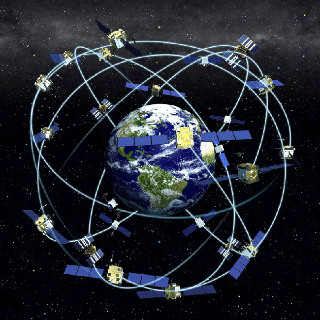
Fig 1: The constellation of GPS satellites
Assisted GPS
Dedicated GPS receivers rely on satellite technology alone to calculate the user’s position. However, GPS receivers integrated into communication devices such as smartphones augment satellite signals with other information such as cellular and WiFi networks. This technology is known as Assisted GPS (A-GPS), and it significantly improves the overall performance of the system.
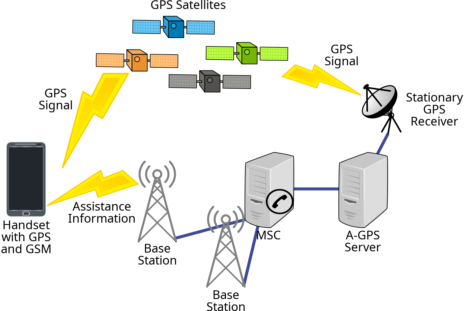
Fig 2: Assisted GPS
Satellite signals are susceptible to blockage by tall buildings, thick forest cover and, to a much lesser extent, adverse weather conditions. As such, it is often difficult for GPS receivers to pick up strong signals in these conditions. Assisted GPS solves this problem by including auxiliary information from cellular and WiFi networks in calculating the user’s position. The device does not need to actually be connected to the WiFi network to be able to use it to improve its location data. Generally, location information obtained from cellular towers or WiFi networks is less accurate than that obtained directly from GPS satellites. However, for most civilian applications, acquiring GPS data faster is more important than high accuracy.
GPS Accuracy
Given it’s complexity, GPS is surprisingly accurate. However, the level of accuracy can vary widely, from as low as 2 meters to more than a few kilometers or more. But what exactly does GPS accuracy measure? A 10 meter GPS accuracy means that if you draw a circle centered on the point reported by the GPS receiver, there is a high probability that the true location is within that circle. Google Maps typically highlights this circle in blue. In the particular case of Android devices, Google defines the exact probability as 68%. For the statistically inclined this is the confidence interval based on one standard deviation, assuming that location errors are random with a normal distribution.
It is important to note that GPS accuracy is affected by a number of factors. These include the number and position of satellites that the GPS receiver is able to connect to, whether the device is stationery or in motion, the quality of the receiver itself, as well as being indoors or outdoors. In general, while dedicated GPS receivers may acquire location information more slowly than smartphone-integrated receivers, they also tend to be more accurate.
So what?
What does all this information mean in practical terms?
A few things.
Firstly, it is important to be clear about why you want to collect location data. Mapping households in a high-density slum area for the purposes of follow-up is obviously a very different problem from merely tracking enumerators collecting data in the field for quality assurance. The former case demands accuracy in the range of 2 to perhaps, 10 meters. In the latter case, however, accuracy as low as 500 meters may be acceptable. Please note that the higher the accuracy number reported (in meters), the lower the accuracy level, and vice versa. For instance, 10 meter accuracy is “more accurate” than 100 meter accuracy.
Secondly, the level of accuracy desired affects your choice of GPS devices. This in turn has budgetary, logistical, training and other implications. For example, most smartphones generally cannot achieve accuracy below 4 meters. In my own experience working with many projects using smartphones location data collection, median accuracy tends to fall within 50 to 70 meters. The range can be highly diverse, starting from as low as 4 meters to as high as 6 or 7 kilometers. Some high-end dual-frequency GPS receivers support real-time positioning within a few centimeters, and long-term measurements at the millimeter level. In between these extremes are a wide range of receivers with different capabilities, and it is important to carefully consider which ones meet your accuracy, budget and complexity requirements.
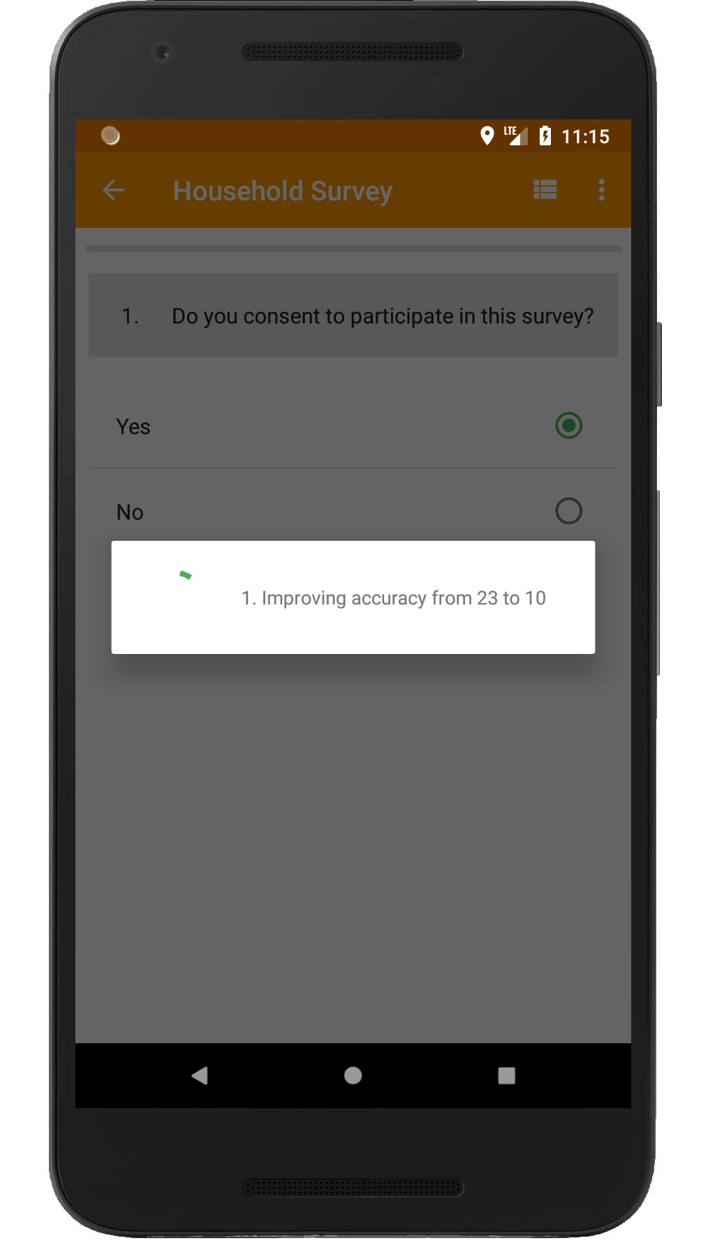
Fig 3: Hoji waiting for location accuracy to improve from 23 meters to 10
Thirdly, some mobile applications allow you to set the desired level of accuracy. This means that you can force the devices to reject accuracy levels below a certain number. Hoji offers this capability, but, while it is a great feature, it is important to carefully consider the trade-off. Setting the accuracy level too high (i.e. a small number) means that the enumerator might have to wait a long time and probably even step out of the building to obtain a strong enough signal. For this reason, we generally advice our customers to not set a minimum accuracy level below 500 meters, especially when enumerators are using their own personal phones which can vary widely in terms of the quality of the GPS receiver installed on them.
Happy mapping!